Sitemap
A list of all the posts and pages found on the site. For you robots out there is an XML version available for digesting as well.
Pages
Posts
Future Blog Post
Published:
This post will show up by default. To disable scheduling of future posts, edit config.yml and set future: false.
Blog Post number 4
Published:
This is a sample blog post. Lorem ipsum I can’t remember the rest of lorem ipsum and don’t have an internet connection right now. Testing testing testing this blog post. Blog posts are cool.
Blog Post number 3
Published:
This is a sample blog post. Lorem ipsum I can’t remember the rest of lorem ipsum and don’t have an internet connection right now. Testing testing testing this blog post. Blog posts are cool.
Blog Post number 2
Published:
This is a sample blog post. Lorem ipsum I can’t remember the rest of lorem ipsum and don’t have an internet connection right now. Testing testing testing this blog post. Blog posts are cool.
Blog Post number 1
Published:
This is a sample blog post. Lorem ipsum I can’t remember the rest of lorem ipsum and don’t have an internet connection right now. Testing testing testing this blog post. Blog posts are cool.
portfolio
Special Issue: Testing the Quality of GeoAI-Generated Data for VGI Mapping
🔗 View Special Issue
I am collaborating with Dr. James D. Carswell as a co-editor of this special issue, . Together, we are leading a timely and critical exploration into the reliability and accuracy of GeoAI-generated geospatial data, particularly within the context of Volunteered Geographic Information (VGI) platforms such as OpenStreetMap.
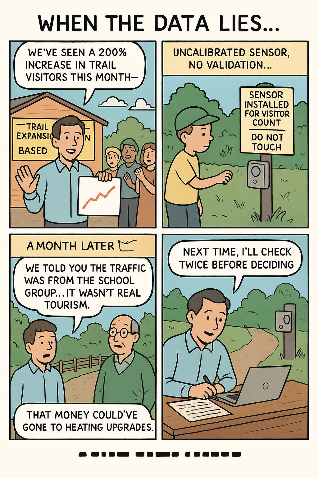
While GeoAI offers immense potential to automate and accelerate map production, the growing concern around data quality — often referred to as ‘AI slop’ (a term describing low-quality or error-prone outputs from artificial intelligence systems) — has raised important questions about the trustworthiness of AI-generated content. This special issue invites empirical research, case studies, and benchmark studies that evaluate how well current GeoAI models perform in real-world conditions, especially when compared to authoritative data sources and community-generated maps.
The issue focuses on:
🔎 Assessing accuracy and reliability of AI-predicted map features
🔎 Evaluating integration of GeoAI outputs into VGI platforms
🔎 Developing QA and benchmarking frameworks for AI-generated spatial data
🔎 Addressing challenges and future directions for AI-assisted mapping
Through this special issue, our goal is to inform both academic and practitioner communities about the current capabilities and limitations of GeoAI in collaborative mapping, and to foster a dialogue between automated approaches and human-led mapping practices.
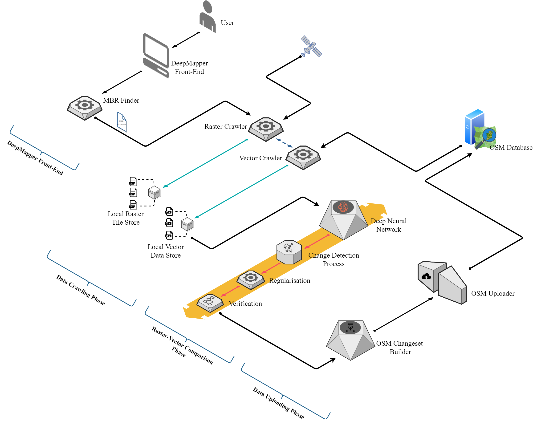
DeepMapper
To get accurate information returned from location-based services (e.g., LBS info on nearby restaurants, retail outlets, points-of-interest, etc.), the underlying map (spatial data) must be up-to-date. However, the built environment (e.g., roads, buildings, bike paths, etc.) can change quickly over time, either through planned developments or as the result of natural/manmade disasters. The problem is that keeping online crowdsourced maps like Open Street Map (OSM) updated is still very much a manual process. As such, it can take considerable time to sync the online maps used by LBS with up-to-date spatial data in ‘real-time’.
Our case study considers the Grangegorman area in Dublin city. It is a green/brownfield site that has seen much infrastructure change in the past decade due to its renewal as the new home for Technological University Dublin (TU Dublin). New buildings have been built, car parks have changed size/location, and new roads have been constructed due to the recent expansion. Figure 2 and Figure 3 illustrate the difference/mismatch between the current OSM crowdsourced (vector) map and Google’s satellite (raster) view of the Grangegorman area.
publications
DeepMapper : Automatic Updating Crowdsourced Maps
Published in TUDublin Annual Research Symposium, 2020
This poster summarizes the proposed research on DeepMapper, a Deep Learning-based approach for automatic updating of crowdsourced maps. The study aims to develop a model that can detect and update changes in OpenStreetMap data, facilitating the maintenance of digital maps through automation.
Recommended citation: Hewa Manage, Lasith Niroshan and Carswell, James, 'DeepMapper : Automatic Updating Crowdsourced Maps' (2020). Other. 3. https://arrow.tudublin.ie/gradcamoth/3
Download Here: https://lasith-niro.github.io/files/deepmapper-poster.pdf
Post-analysis of OSM-GAN Spatial Change Detection
Published in ISPRS International Journal of Geo-Information, 2022
This paper presents a post-analysis of OSM-GAN, a generative adversarial network for spatial change detection in OpenStreetMap data. The study evaluates the model's performance in detecting building footprint changes over time, demonstrating its potential for monitoring urban growth and development.
Recommended citation: Niroshan, L. and Carswell, J.D., 2022. Post-analysis of OSM-GAN spatial change detection. ISPRS International Journal of Geo-Information, 11(5), p.295Niroshan, L., Carswell, J.D. (2022). Post-analysis of OSM-GAN Spatial Change Detection. In: Karimipour, F., Storandt, S. (eds) Web and Wireless Geographical Information Systems. W2GIS 2022. Lecture Notes in Computer Science, vol 13238. Springer, Cham. https://doi.org/10.1007/978-3-031-06245-2_3
Download Here: https://lasith-niro.github.io/files/post-osm-gan.pdf
Machine Learning with Kay
Published in AGILE: GIScience Series, 2022
This paper explores using Ireland's national supercomputer, Kay, to train Deep Learning models for remote sensing tasks, specifically extracting buildings from satellite imagery. Leveraging Kay's GPU clusters showcases significant advancements in computational efficiency for handling large-scale data in this domain.
Recommended citation: Niroshan, L. and Carswell, J.D., 2022. Machine learning with kay. AGILE: GIScience Series, 3, p.11.
Download Here: https://lasith-niro.github.io/files/ml-with-kay.pdf
OSM-GAN: Using Generative Adversarial Networks for Detecting Change in High-Resolution Spatial Images
Published in International Conference on Geoinformatics and Data Analysis, 2022
This paper introduces OSM-GAN, a novel approach for detecting spatial changes in high-resolution satellite images. The model leverages generative adversarial networks to identify building footprint changes in OpenStreetMap data, demonstrating its potential for monitoring urban development.
Recommended citation: Niroshan, L. and Carswell, J.D., 2022. OSM-GAN: Using Generative Adversarial Networks for Detecting Change in High-Resolution Spatial Images. In International Conference on Geoinformatics and Data Analysis (pp. 179-193). Springer, Cham.
Download Here: https://lasith-niro.github.io/files/osm-gan.pdf
Poly-GAN: Regularizing Polygons with Generative Adversarial Networks
Published in Lecture Notes in Computer Science, 2023
This paper introduces Poly-GAN, a data-driven approach utilizing Deep Learning to regularize irregular building footprints from OpenStreetMap data. Poly-GAN aims to optimize polygonal representations of buildings for digital maps, addressing limitations of traditional methods in accuracy and efficiency.
Recommended citation: Niroshan, L. and Carswell, J.D., 2023, June. Poly-GAN: Regularizing Polygons with Generative Adversarial Networks. In International Symposium on Web and Wireless Geographical Information Systems (pp. 179-193). Cham: Springer Nature Switzerland.
Download Here: https://lasith-niro.github.io/files/polygan.pdf
A Playful Participatory Planning System (P-PPS): A Framework for Collecting and Analyzing Player-Generated Spatial Data from Minecraft Worlds
Published in ISPRS International Journal of Geo-Information, 2025
Recommended citation: de Sena, Í., Niroshan, L., Rosecký, J., Brůža, V., Butler, M., Cocco, C., 2025. A Playful Participatory Planning System (P-PPS): A Framework for Collecting and Analyzing Player-Generated Spatial Data from Minecraft Worlds. ISPRS International Journal of Geo-Information. https://doi.org/10.3390/ijgi14060210
Download Here: https://www.mdpi.com/2220-9964/14/6/210
DeepMapper: A GeoAI Approach to Automate the VGI Mapping Workflow
Published in IEEE Journal of Selected Topics in Applied Earth Observations and Remote Sensing, 2025
Recommended citation: Niroshan, L., Carswell, J., 2025. DeepMapper: A GeoAI Approach to Automate the VGI Mapping Workflow. IEEE Journal of Selected Topics in Applied Earth Observations and Remote Sensing. https://doi.org/10.1109/jstars.2025.3581499
Download Here: https://ieeexplore.ieee.org/abstract/document/11045930
Design and implementation of a data sharing API for supporting urban governance schemes in environmental and traffic monitoring
Published in MethodsX, 2025
Recommended citation: Niroshan, L., Moslem, S., Pilla, F., 2025. Design and implementation of a data sharing API for supporting urban governance schemes in environmental and traffic monitoring. MethodsX. https://doi.org/10.1016/j.mex.2025.103458
Download Here: https://www.sciencedirect.com/science/article/pii/S2215016125003036
Evaluating GeoAI-Generated Data for Maintaining VGI Maps
Published in LAND-MDPI, 2025
Recommended citation: Niroshan, L., & Carswell, J. D. (2025). Evaluating GeoAI-Generated Data for Maintaining VGI Maps. Land, 14(10), 1978. https://doi.org/10.3390/land14101978
Download Here: https://doi.org/10.3390/land14101978
talks
Conference Presentation on Poly-GAN
Published:
This presentation introduces Poly-GAN, an innovative approach leveraging Deep Learning to enhance the regularization of building footprints extracted from OpenStreetMap data. Poly-GAN aims to streamline polygonal representations of buildings, optimizing them for digital mapping applications by minimizing storage space and bandwidth usage while preserving geographic accuracy.
teaching
PLAN10040 - Research methods
Undergrad, School of Architecture, Plan & Env Pol, University College Dublin, 2024
PLAN40350 - Advanced GIS
Masters, School of Architecture, Plan & Env Pol, University College Dublin, 2025

